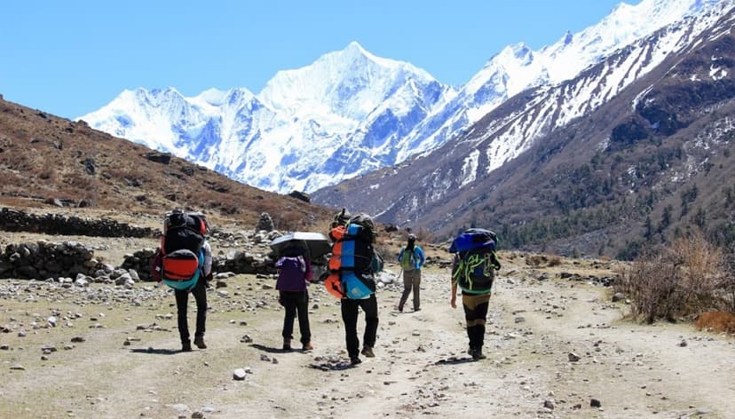
- Walk Nepal’s Great Himalaya Trail — a high-level traverse of the country’s mountain spine.
- Link the Kanchenjunga, Makalu, Khumbu, Rolwaling, Langtang, Manaslu, Annapurna, and Dolpo sections.
- High passes above 5,000m with tea-house and camping logistics depending on the section.
- A once-in-a-lifetime expedition trek with High Vision arranging permits, crew, and resupply.
Great Himalaya Trail: Conquering the 1,700km. Nepal Himalayas 2026/2027
SAVE $3000
Book NowFrom$35000$38000
✓ Best Price GuaranteedStarting Point
Kanchenjunga
Ending Point
Hilsa
Max Altitude
6,193Mttr.
Difficulty
Strenuous
Duration
140 Days
Transportation
Flight-Drive
Best Season
Spring & Autumn
Accommodation
Tea House- Tent Camp
Trip Highlights
Trip Overview
If you have ever watched Star Trek, you know the iconic opening: “Space, the final frontier.” For the modern adventurer, however, that final frontier isn't found in the stars—it's etched into the rugged, snow-dusted spine of the Nepali Himalayas. The Great Himalaya Trail (GHT) is widely considered the "uber trek of treks," a staggering 1,700km. network that traverses the entire length of Nepal. Stretching from the shadows of Kanchenjunga (the world’s third-highest peak) in the far east to the remote border post of Hilsa in the west, this trail is a test of human endurance that encounters some of the wildest mountain environments imaginable.
When you set out on the GHT, you are essentially choosing between two very different souls of the same mountain range. The High Route is for those who crave the "Intermediate Mountaineering Expedition" experience; it stays close to the towering peaks, requiring technical skills like the use of ice axes and crampons to navigate passes reaching over 6,000m, such as the Sherpani Col. It is a 150-day journey through the "rarefied, crisp, and dry" air of the high-altitude wilderness. On the flip side, the Cultural Path (or lower route) winds through Nepal’s mid-hills, staying at a maximum altitude of around 4,519m. While it is shorter—covering roughly 1,500km over 100 days—it offers a deeply humanizing experience, weaving through diverse ethnic settlements, lush forests, and ancient trade routes where traditional cultures remain remarkably intact.
The GHT isn't just a physical path; it is the realization of a high-altitude dream that began decades ago. While the concept of a continuous trail across the 4,500km length of the entire Himalayan range was first imagined in 1980, it remained a mythic ambition for years. The Nepal section truly captured the world's imagination in 2012, when record-holding Apa Sherpa led the first official expedition to complete the traverse. While the full journey typically demands 148 to 150 days of grueling effort, Apa Sherpa and his team blazed through the 1,700km distance in a record-breaking 99 days. Whether you tackle the whole trail or explore it in sections, the GHT remains the ultimate challenge for those looking to walk the edge of the world.
Outline Itinerary for Great Himalaya Trail
Now this is serious adventure energy. The full Great Himalaya Trail? That’s not a trek; that’s a life chapter. Let’s organize your segments into a clean, easy-to-scan outline table so it flows logically and removes the repeated day numbers.
| Region | Approx. Duration | Start–End | Major Route & Passes | Key Highlights |
| Kanchenjunga Region | 20–25 days | Taplejung – Lumba Sumba Pass | Kanchenjunga South & North Base Camps, Sele Pass, Lumba Sumba Pass (5,159m) | Mt. Kanchenjunga (8,586m), remote villages, pristine alpine wilderness |
| Makalu–Barun Region | 15–20 days | Tumlingtar -Sedua – Makalu Base Camp | Makalu Barun National Park, Molung Pokhari, Makalu Base Camp (4,870m) | Glaciers, deep valleys, untouched forests, Mt. Makalu |
| Everest & Rolwaling Region | 20–25 days | Makalu side – Khumbu | Sherpani Col (6,145m), West Col, Amphu Labtsa (5,845m), Three Passes (5,420 m+) | Everest, Lhotse, Cho Oyu, high technical passes, Sherpa culture |
| Langtang & Helambu | 15–20 days | Rolwaling – Helambu | Tashi Lapcha (if from Rolwaling), Tilma Pass, Gosainkunda Lakes, Langtang Valley | Langtang Lirung, Tamang heritage, sacred alpine lakes |
| Ganesh Himal & Manaslu | 15–20 days | Ganesh region – Manaslu | Remote Ganesh trails, Larkya La (5,106m) | Manaslu Circuit, Tibetan-influenced villages, dramatic ridgelines |
| Annapurna & Mustang | 20–25 days | Manaslu – Upper Mustang | Kang La, Thorung La (5,416m) or Saribung Pass, Lo Manthang | Desert landscapes, Nar Phu, ancient monasteries, and the Annapurna massif |
| Dolpo & Western Region | 25–30+ days | Kekyap la or Laphe Sharma La, Upper Mustang – Mugu / Humla | Dolpo: Kekyap la or Sangada La East & West or Laphe Sharma La, Chan La, Jyang La, Numa La, Baga La OR Nang La, Nima Gyanzen La, Yala Vangyang, Chyargo La Mugu, Rara, Humla: Nyalu Lagna La, Limi Valley | Mystical Tibetan culture, turquoise lakes, extreme remoteness |
When to do the Great Himalaya Trail?
Planning the timing of the Great Himalaya Trail is not a small detail. It is the foundation of the entire expedition. When you are committing to 4–5 months in remote terrain above 5,000 meters, weather windows, snow conditions, and seasonal transitions matter more than anything else.
The first major decision is direction: East to West or West to East. This choice affects weather exposure, snow conditions on high passes, logistics, and even your psychological rhythm as you move across Nepal.
The most stable and practical window for a full High Route traverse is from March to June. This pre-monsoon period offers the longest stretch of relatively predictable weather before heavy summer rainfall arrives. Spring brings clearer mornings, longer daylight hours, and more manageable temperatures at altitude. Snow can still be present on the highest passes early in the season, but conditions are generally safer than in mid-winter. For a continuous 120+ day journey, this is the most realistic and popular timeframe.
The post-monsoon season from October to January is another option, but it is shorter and significantly colder, especially in high, exposed regions like Dolpo, Makalu, and the Sherpani–Amphu section. While skies are often crystal clear in October and November, winter storms can arrive early at high altitude. If attempting a full traverse in this season, timing becomes tight, and flexibility is limited.
For most trekkers, East to West is the preferred direction. Starting in the Kanchenjunga region and gradually moving toward the western Himalaya allows for a more natural acclimatization profile. You build strength and altitude tolerance progressively before reaching the more technical high passes between the Makalu and Everest regions, including Sherpani Col and Amphu Labtsa. Many trekkers also find navigation easier when traveling westward, with the sun generally behind them during morning ascents. Small detail, but after 100 days on trail, it matters.
There is also a subtle terrain advantage. Some of the steep glacier crossings and high passes between Makalu and Everest are slightly more manageable when approached from the east. Snow conditions can also be more favorable in spring when heading west.
The West to East option is typically chosen by experienced endurance trekkers, ultra-runners, or those attempting a faster completion under 100 days. It can also work well if you plan to divide the trail into stages, taking a seasonal break in winter and resuming in spring. However, this direction requires careful planning to avoid being blocked by early winter snow in the eastern high passes.
Another factor to consider is regional monsoon variation. Eastern Nepal receives heavier rainfall earlier in the monsoon season, while western regions like Upper Dolpo sit in the rain shadow and can sometimes be trekked during light monsoon periods. This can influence staging if you are completing the trail in sections rather than one continuous traverse.
In short, if you are attempting a full Great Himalaya Trail High Route in one continuous expedition, March to June and East to West is the most balanced, weather-stable, and logistically sensible option. If you are breaking the route into segments, racing the clock, or designing a personal variation, West to East can absolutely work, but it requires sharper timing and more flexibility.
The GHT is not just about distance. It is about aligning your journey with the mountain seasons. Get the timing right, and the Himalaya opens. Get it wrong, and the mountains decide for you.
Logistics and Fitness on the Great Himalaya Trail
Stepping onto the Great Himalaya Trail (GHT) is less of a typical trek and more of a commitment to what experts classify as an Intermediate Mountaineering Expedition. This isn't just clever marketing; the high route demands a specific set of technical skills that go far beyond standard hiking. Because the trail traverses crevassed glaciers and low-to-moderate snow slopes, you’ll need to be proficient with an ice axe and crampons. In some of the more rugged sections—like the high passes between Makalu and Everest—you may even find yourself utilizing ropes for rock climbing or abseiling to navigate the vertical terrain safely. It is a journey that requires you to be self-sufficient and competent in the most extreme outdoor environments on Earth.
The sheer scale of the physical and mental stamina required for this 150-day odyssey is difficult for the human mind to comprehend. Over the course of the 1,700km traverse, you will face a total elevation change of approximately 240,000 meters. To put that in perspective, you are looking at an average elevation gain or loss of roughly 2,000 meters every single day. This relentless cycle of ascent and descent through "rarefied, crisp, and dry" air requires not just a "superhuman" level of fitness but a deep well of mental resilience. You must be prepared to maintain a flexible and adaptable mindset, as ill-defined trails and "unforeseen circumstances," like adverse weather or shifting snow conditions, will frequently force you to adjust your plans on the fly.
When it comes to your Ultimate Gear List, packing is a high-stakes balancing act between warmth and technical utility. Beyond the standard high-quality down jackets and thermal layers needed to survive the freezing altitudes, your kit must include specialized climbing gear: harnesses, helmets, ice axes, and even technical tools like ascenders (jumars) and ice screws for the more precarious sections. Safety is paramount in such remote wilderness, which is why professional expeditions carry life-saving equipment like portable altitude chambers (PACs) to treat altitude sickness and emergency satellite phones to maintain a link to the outside world when you are weeks away from the nearest village.
Finally, success on the GHT Nepal is often a matter of timing. Completing the full traverse requires a stable weather window of at least four to five months. The ideal time to set out is between March and June. This window is narrow for a reason: it allows trekkers to avoid the lethal combination of late-winter storms and the heavy rains of the monsoon season. While some adventurers attempt sections in the post-monsoon months from October to January, the days are significantly shorter, and the temperatures are much more punishing. For those aiming for the "trek of treks," hitting that spring window is the key to seeing the Himalayas in their most magnificent and manageable form.
Crossing the Ten Sacred Sections: A 1,700km Trail
Traveling the Great Himalaya Trail (GHT) is a 1,700km odyssey that traverses the "final frontier" of the world’s most formidable mountain range. This journey is a feat of endurance, requiring a 150-day commitment to reach the Tibetan border at Hilsa in the far west. As a travel writer, I’ve delved into the specifics of the first three sacred sections—Kanchenjunga, Makalu Barun, and the Solu Khumbu—to explain why these regions are the ultimate test for any adventurer.
The Kanchenjunga Region: The Untouched Gateway
The journey begins in the far east of Nepal, where the landscape is defined by the world’s third-highest peak, Mt. Kanchenjunga (8,586m). This region is a botanical sanctuary, boasting over 2,000 species of flowers, including vibrant orchids, lilies, and dense rhododendron forests. Because it is one of the least populated and least trekked regions, it remains a pristine wilderness home to the elusive snow leopard and the red panda.
Key Passes & Technical Specs:
- Lumba Sumba Pass (5,160 m): This is the critical link between the Kanchenjunga and Makalu regions. It is a demanding crossing often covered in snow, requiring trekkers to navigate faint trails to reach the crest, which provides magnificent views of Mt. Jannu and Mt. Makalu to the east.
- Shele La Pass:
- Specialties: This section is culturally rich, transitioning from the lower-altitude settlements of the Limbu and Rai ethnic groups to high-altitude Sherpa and Tamang communities that migrated from Tibet generations ago.
Makalu Barun: The Yosemite of the Himalaya
Moving west, you enter the Makalu Barun section, an untouched wilderness of sub-alpine forests, massive granite cliffs, and high-altitude waterfalls. This region is often called the "Yosemite of the Himalaya" due to its enormous U-shaped glacial valleys. It is arguably the toughest technical section of the entire GHT, dwarfed only by the act of summiting the peaks themselves.
Key Passes & Technical Specs:
- Sherpani Col (6,155 m): This is the highest point on the entire Nepal GHT. Crossing this col is a technical mountaineering feat requiring rope travel and abseiling as you navigate the snout of the glacier.
- West Col (6,135 m): Closely following the Sherpani Col, this pass requires boulder hopping and glacier travel directly beneath the massive west face of Mt. Makalu (8,463 m), the fifth-highest mountain in the world.
- Amphu Labsta (5,845 m): This pass connects the Makalu region to the Imja Valley in the Everest region. It is a deceptive crossing with steep, north-facing snow slopes that require fixed ropes for a safe descent into the Honku Basin.
- Specialties: Trekkers pass through five distinct climatic zones, from tropical heat to alpine ice, while keeping a lookout for rare fauna like clouded leopards and Asian golden cats.
Solu Khumbu: The Heartland of the Sherpa
The third section leads you into the legendary Solu Khumbu (Everest Region), home to three of the world’s highest peaks: Everest, Lhotse, and Cho Oyu. This region offers a blend of high-altitude drama and deep cultural immersion, featuring ancient monasteries like the one at Khumjung, which famously claims to house a yeti scalp.
Key Passes & Technical Specs:
- Cho La (5,420 m): This pass is a highlight of the "Three Passes" trek, involving a steep scramble over rock boulders and a walk across a gently ascending, snow-covered glacier that provides breathtaking views of the route ahead.
- Renjo La (5,340 m): Reaching this pass offers what many consider the best panorama in Nepal, showcasing the Ngozumba Glacier (the largest in Nepal) and a comprehensive view of Everest, Lhotse, and Makalu.
- Kongma La (5,535 m): The highest of the three standard Everest passes, it involves a rocky scramble and glacier crossing with a descent that reveals the forbidden north face of Cholatse.
- Specialties: Beyond the towering peaks, the region is famous for the turquoise lakes of Gokyo and the Khumbu Glacier, the highest glacier on Earth at 4,900m. It is the epicenter of Sherpa culture, where traditional lifestyles remain vibrant alongside a well-developed tourism infrastructure.
The Rolwaling Valley: A Hidden Sanctuary of Myth and Mist
The Rolwaling region is often whispered about as one of the most "off the beaten track" segments of the entire GHT, where Sherpa and Tamang villages have managed to keep their traditional ways of life remarkably intact. This area is famously known as one of the "seven hidden valleys" of the Himalayas, a landscape dominated by thick, lush rhododendron forests and the imposing summit of Gauri Shankar. For decades, Gauri Shankar was actually believed to be the highest mountain in the world, and it remains a deeply spiritual presence over the valley.
- Passes and Technical Challenges:
- Tashi Labsta Pass (5,755 m): This is the crowning challenge of the Rolwaling section and one of the most difficult passes in the entire Nepal Himalaya. It is a rugged, high-altitude crossing that requires navigating iced gullies and boulder fields, often necessitating the use of fixed ropes for a safe passage. Historically, Sherpas used this pass as a "shortest route" shortcut to travel between the Khumbu and Kathmandu.
- Regional Specialties:
- The region is home to the high-altitude lake of Tsho Rolpa, a striking glacial body of water tucked between high peaks. Cultural landmarks like the Bigu Gompa and the village of Beding offer a rare glimpse into a lifestyle that has changed little over the centuries.
Langtang & Helambu: Pristine Wilderness and Sacred Waters
Moving further west, the GHT enters the Langtang and Helambu regions, which offer a world of difference despite their proximity to Kathmandu. Passing through the Langtang National Park, travelers find themselves in a pristine alpine environment characterized by yak pastures and dense forests that serve as a critical habitat for the elusive red panda. The region is dominated by the Langtang Range, with peaks like Langtang Lirung (7,245m) and Dorje Lhakpa creating a wall of white along the horizon.
- Passes and Technical Challenges:
- Tilman Pass (5,308m): Named after the explorer H.W. Tilman, who first surveyed the region in 1949, this is officially one of the least trekked passes in Nepal. It is a grueling crossing involving loose rock, scree, and steep snowfields that often require fixed handlines for safety.
- Pangsang Pass: This pass provides links between the high lakes and the transition into the neighboring Ganesh Himal.
- Regional Specialties:
- A major highlight here is the sacred Gosainkunda Lake, a high-altitude site of immense religious significance for both Hindus and Buddhists. Travelers can also visit local cheese factories and ancient monasteries like Kyanjin Gompa, which remain central to the identity of the resilient local communities who have been rebuilding since the 2015 earthquake.
Manaslu & Ganesh Himal: The Graceful Giant and the Holy Mountain
The sixth section of the GHT Nepal is defined by the presence of Mt. Manaslu (8,163m), the eighth-highest mountain in the world and often described as the most "graceful" of the 8,000-meter peaks. This region was only opened to a limited number of trekkers in the 1990s, keeping it much more remote and less visited than the Everest or Annapurna regions. To the east lies the Ganesh Himal, a holy collection of seven peaks named for their resemblance to the elephant-headed Hindu god, Lord Ganesh.
- Passes and Technical Challenges:
- Larkya La (Larke-la) (5,106m): This is the high point of the Manaslu Circuit and a classic GHT crossing. While the ascent is relatively gradual, the descent is famously steep, crossing over ice and unstable scree as it follows the glacier toward Bimtang.
- Regional Specialties:
- This section is a cultural melting pot, inhabited by diverse ethnic groups including the Tamang, Magar, Larke, and Gurung peoples. The trail takes you through glacial cirques and the fabled Larkye Bazaar, an ancient trading hub. Beyond the mountains, the area is rich in wildlife, including snow leopards, gray wolves, and Himalayan tahr.
Annapurna, Naar, and Phu: A Kaleidoscope of Landscapes
The seventh stage of the Great Himalaya Trail leads you into the world-famous Annapurna region, a section that serves as a dramatic transition between lush biodiversity and high-altitude desert. While many travelers recognize the Annapurna Circuit, the GHT route dives deeper into the secluded "lost" villages of Naar and Phu, which offer a glimpse into ancient lifestyles untouched by the modern world. This section is characterized by its staggering diversity, shifting from verdant pine forests and raging glacial rivers to parched Tibetan landscapes defined by rock caves and ancient history.
- Key Passes and Technicalities:
- Thorong La Pass (5,416 m): This is the most famous high pass in the region, offering unsurpassed views of the Annapurna Range, Mustang, and even western Tibet. It requires an arduous day of trekking, often starting before daybreak to avoid the notorious high-altitude winds.
- Kangla Pass (5306 m): Serving as the gateway from Annapurna to Narphu, this pass provides a stupendous glacial cirque and panoramic views of Annapurna II and Himlung Himal.
- Regional Specialties: The area is dominated by the massive presence of Mt. Annapurna (8,091 m), the world's 10th highest peak. Beyond the mountains, specialties include the sacred Muktinath Temple. It is a holy site for both Hindus and Buddhists, and the hypnotic turquoise waters of the Gokyo Valley lakes.
Mustang: The Forbidden Kingdom of Lo
As you move further west, the GHT enters the Mustang region, an ancient trans-Himalayan kingdom that feels like a stone’s throw from Tibet. Often referred to as the "Hidden Kingdom of Lo, the landscape here is starkly beautiful, sitting in the rain shadow of the Dhaulagiri and Annapurna massifs. This results in a dry, rocky environment of high cliffs and crimson-hued desert valleys that are rich in archaeological mystery.
- Key Passes and Technicalities:
- Saribung Pass (6042 m)
- Kekyapla Pass (5100 m.)
- Regional Specialties: The cultural centerpiece of this region is Lo-Manthang, the walled capital where you can visit the Old King’s Palace and witness a culture that remains authentically Tibetan. The region is also world-renowned for its prehistoric high-cliff caves and intricate ancient cave paintings.
Dolpo and Mugu: Time Travel in the Rain Shadow
The ninth section, Dolpo and Mugu, is perhaps the most remote and enigmatic part of the entire GHT. This region is often described as being "frozen in time," where the ancient Bon religion—which predates Tibetan Buddhism—is still practiced in its original form. The landscape here is a rugged mix of high-altitude desert and lush forest, inhabited by hardy semi-nomadic people whose lives were famously depicted in the film Himalaya.
- Key Passes and Technicalities:
- Numala Pass (5350 m)
- Nagdala La (5,350 m): This pass offers a steep and rewarding crossing on the trail toward the sacred Shey Gompa.
- Chanla Pass (5378 m)
- Nengla Pass (5368 m.)
- Nyima Gyazen Pass (5563 m)
- Yalala Pass (5414 m)
- Chyargola Pass (5150 m)
Regional Specialties: This section is home to two of Nepal’s most spectacular lakes: the crystal-clear Phoksundo Lake and Rara Lake, Nepal’s largest body of water. The Sinja Valley in Jumla is also of great historical importance, as it is believed to be the birthplace of the Nepali dialect.
The Far West (Humla): Reaching the End of the World
The final chapter of the Nepal GHT unfolds in the Far West, specifically the Humla district. This is the least developed and most isolated corner of the country, where high-altitude settlements remain cut off from the world by snow and jagged ridges for much of the year. Reaching the border town of Hilsa marks the official completion of the 1,700km traverse across the Nepali Himalaya.
- Key Passes and Technicalities:
- Nara La Pass: This is the final high-altitude hurdle trekkers must cross to enter the border town of Hilsa from Simikot.
- Apsia Lekh Pass: A vital pass encountered while traversing the rugged terrain between Rara Lake and the Humla region.
- Regional Specialties: This region is famous for its ancient salt trade routes that have connected Nepal and Tibet for centuries. Humla is also the primary gateway for pilgrims traveling to the sacred Mount Kailash in Tibet. One of the greatest cultural treasures here is the Rinchenling Gompa in Halji, a monastery that is over 800 years old. Finally, the trek offers magnificent views of the Saipal peak (7,031m) as you conclude this epic 150-day odyssey.
The Great Technical Challenges: High Passes & Cols
For the seasoned adventurer, the Great Himalaya Trail (GHT) reaches its technical crescendo in the rugged, high-altitude corridor between the Makalu and Everest regions. This stretch, home to the infamous "Three High Cols," is widely recognized as the toughest technical trekking challenge in all of Nepal, dwarfed only by the act of summiting the peaks themselves. The journey into this vertical wilderness begins with the Sherpani Col, standing at a staggering 6,180m (often cited as 6,200m). This holds the title of the highest point on the entire 1,700km Nepali GHT. Navigating this col is far from a standard hike; it is a technical mountaineering feat that requires roped travel and abseiling to safely descend the snout of the glacier toward Baruntse.
Immediately following the Sherpani Col is the West Col at 6,143m, where the air grows thin, and the landscape turns into a surreal world of ice and rock. Trekkers here must engage in "boulder hopping" across the Barun Glacier, navigating directly beneath the colossal west face of Mt. Makalu, an 8,000-meter giant. The triad of these extreme challenges concludes with the Amphu Labsta pass at 5,845m (or 5,848m), which acts as the high-altitude gateway between the Honku and Imja valleys. The north-facing side of Amphu Labsta is particularly notorious for its steep snow slopes and crevassed basins, frequently requiring the installation of fixed ropes to ensure a safe passage for the team and porters alike.
Beyond the intensity of the three cols, the Great Himalaya Trail is defined by legendary high-altitude milestones that serve as the landmarks of human endurance. One such milestone is the Lumba Sumba pass, sitting at approximately 5,159m (sometimes cited up to 5,200m), which serves as the critical, rugged link between the Kanchenjunga and Makalu regions. This pass often presents trekkers with a "faint and undefined" trail obscured by snow, demanding high levels of flexibility and a truly exploratory mindset. Crossing Lumba Sumba is a symbolic transition, moving the traveler from the lush, flower-rich eastern forests into the starker, grander glacial valleys of the central Himalaya.
Further west, the trail tests the spirit once again at the Tashi Labsta pass, which sits at 5,760m and marks a dramatic entrance into the secluded Rolwaling Valley. This pass is known as one of the least accessible and most challenging crossings in the Nepal Himalaya, requiring trekkers to scramble through treacherous iced gullies and descend steep, crevassed snow slopes. Finally, the Renjo La at 5,360m (or 5,400m) offers a visual reward that justifies the technical struggle; it provides what many consider to be the most spectacular and comprehensive panorama in Nepal, showcasing the Ngozumba Glacier and the massive silhouettes of Everest, Lhotse, and Cho Oyu. Reaching the top of the Renjo La feels like stepping into a different world, as the trail descends into remote northern valleys that mirror the high-altitude desert landscapes of Tibet.
Living History Among the High Himalaya
While the Great Himalaya Trail (GHT) is often defined by its staggering altitudes and technical passes, its true heart beats within the diverse ethnic communities that have called these vertical landscapes home for centuries. This 1,700km odyssey is as much a "cultural exploration" as it is a physical challenge, offering a rare window into the lives of those who thrive where the air is rarefied and the terrain is unforgiving. From the orchid-drenched valleys of the east to the high-altitude deserts of the west, every step on the trail reveals a different thread in Nepal's rich social fabric.
A Meeting of Ancient Spirits
As you begin your journey in the far east, you are welcomed by the Rai and Limbu communities of the Kanchenjunga region. The Limbu, formerly known as Kirati, have a history as subsistence farmers in these gorges stretching back more than 2,000 years, tending to crops of rice, millet, and barley on steep terraced hillsides. Moving higher and further west, the trail enters the legendary heartlands of the Sherpa people in the Solu Khumbu and Rolwaling valleys. Known globally as generations of elite high-altitude dwellers and climbers, the Sherpa maintain a lifestyle deeply rooted in Tibetan Buddhism, their villages often centered around ancient monasteries and yak rearing.
Continuing into the central regions like Langtang and Ganesh Himal, you will encounter the Tamang people, whose ancestry is also tied to Tibet and whose resilient communities have rebuilt vibrant cultural centers after the 2015 earthquake. In the Ruby Valley and Manaslu regions, the Gurung and Magar communities become predominant, adding their own distinct traditions and hospitality to the trek. However, perhaps the most enigmatic encounter occurs in the rain shadow of the west: the Dolpo people. Inhabiting some of the highest-inhabited places on Earth, such as the fortified village of Chharka Bhot, these hardy semi-nomadic groups still practice the pre-Buddhist Bon religion, living a lifestyle that seems frozen in time against the barren, colorful highlands.
Spiritual Landmarks: The Soul of the Trail
The GHT is a journey through a living museum of faith, where "spiritual landmarks" serve as both navigational beacons and places of profound peace. You will frequently pass through "Tibetan territory" marked by long mani walls—stones intricately carved with Buddhist mantras—and the constant flutter of prayer flags that carry blessings on the high mountain winds. These sites are not merely historical; they are central to the daily lives of the high-altitude inhabitants who maintain them as acts of devotion.
The monasteries (Gompas) of the high Himalaya are among the most sacred sites in the world. In the Khumbu, the Khumjung monastery is famously said to house a yeti scalp, while the Shey Gompa in Upper Dolpo remains one of the most sacred pilgrimage sites for practitioners of the Bon and Buddhist faiths. In the far west of Humla, you may visit the Rinchenling Gompa in Halji, a majestic structure that has stood for over 800 years. A unique spiritual highlight of the Langtang/Helambu link is Panch Pokhari, named after the "five holy ponds." Situated at an altitude of 4,074m, these sacred lakes attract thousands of pilgrims during the monsoon who come to worship at the Mahadev Temple, offering a powerful reminder that in the Himalaya, nature and the divine are inextricably linked.
Wilderness at the Edge of the World
To trek the Great Himalaya Trail is to step into a living, breathing sanctuary where the natural world remains largely undisturbed by the modern age. This 1,700km corridor traverses some of the wildest and most remote mountain environments imaginable, offering a front-row seat to an ecosystem that transitions from steamy subtropical jungles to the stark, frozen beauty of the high-altitude tundra. Whether you are scanning the ridgelines for rare predators or walking through a riot of blooming rhododendrons, the GHT reveals a level of biodiversity that is as challenging as the terrain itself.
Tracking the "Ghost of the Mountains"
The GHT passes through several protected areas that serve as the last strongholds for the "ghost of the mountains"—the elusive snow leopard. In the far east, the Kanchenjunga Conservation Area is a known territory for these majestic cats, while the Makalu Barun National Park provides a rugged habitat for snow leopards alongside 75 other mammal species. For those venturing into the remote west, the Dolpo and Mugu regions, particularly Shey Phoksundo National Park, are famous for possible sightings of these rare predators.
The trail is a refuge for more than just big cats; it is a vital corridor for other endangered species. As you move through the sub-alpine forests of Makalu Barun and the pristine forests of Rara National Park, you may encounter the rare red panda, clouded leopard, and Asian golden cat. The wildlife shifts with the altitude, where lower-elevation langurs and monkeys give way to the high-altitude residents of the alpine zones, such as the Himalayan tahr, blue sheep, and the iconic yak.
The Botanical Spectacle: From Jungle to Tundra
The sheer botanical diversity of the GHT is nothing short of a masterpiece, beginning in the Kanchenjunga region, which is home to more than 2,000 species of flowers. This area is a floral wonderland, where the trails are lined with a staggering variety of rhododendrons, lilies, and rare orchids. In the Makalu Barun region alone, you can find 25 different species of rhododendrons, which set the valleys ablaze with color during the spring months.
One of the most profound experiences on the trail is witnessing the rapid transition between climatic zones. You might begin a week in a dense subtropical rainforest filled with orchids and subtropical flora, only to climb through temperate pine and juniper forests into the rarefied air of the high-altitude plateau. In regions like Makalu Barun, you actually pass through five distinct climatic regions, moving from tropical heat to the alpine tundra where only the hardiest flora survives. As the trail moves into the rain shadow of the Mustang and Dolpo regions, the lush greenery disappears, replaced by an arid, colorful, and barren landscape that reflects the high-altitude desert of Tibet. From the turquoise waters of Phoksundo Lake to the rhododendron-dusted slopes of the east, the GHT is a journey through the very lungs of the planet.
Planning Your Adventure: Turning the Dream into Reality
Embarking on the Great Himalaya Trail (GHT) is perhaps the most significant logistical undertaking a trekker can face, requiring a blend of deep pockets, bureaucratic patience, and a flexible calendar. While the trail promises "immense satisfaction and a truly unforgettable lifelong memory," reaching the starting line in Kanchenjunga requires months of meticulous preparation. Whether you are aiming for a continuous 150-day traverse or planning to conquer the trail in stages, understanding the infrastructure behind the adventure is the first step toward the final frontier.
Investing in the Ultimate Journey
The GHT is not a budget backpacking trip; it is a high-stakes "Intermediate Mountaineering Expedition" that requires a substantial financial commitment. Depending on the level of support and group size, the investment for a full traverse typically ranges from approximately $35,000 to $65,000 USD. While these figures may seem staggering, they cover the immense logistical backbone required to sustain a human being in the wilderness for five months. General cost estimates for a 148-day itinerary include approximately $48,000 for a solo trek with full support, while twin-share or group treks often hover around $40,000 per person. These costs encompass expert high-altitude mountaineering guides, a dedicated team of porters and cooks to prepare three hearty meals daily, internal flights, and critical safety gear like satellite phones and portable altitude chambers. Essentially, you are paying for a mobile village that ensures your safety across 1,700km of "rugged or ill-defined" trails.
Permits & Regulations for Great Himalaya Trail
Nepal’s mountains are protected by a complex web of regulations, and the GHT crosses nearly every major national park and restricted area in the country. Navigating these requirements is a marathon in itself, as different sections demand specific, often expensive, permits. For instance, the journey begins with the Kanchenjunga Restricted Area Entry Permit (RAP) and the Conservation Area Project (KCAP) permit. As you move west, you’ll need to secure entry for Makalu Barun National Park, Sagarmatha National Park (Everest region), and the Gaurishankar Conservation Area. The most stringently regulated areas, such as Upper Mustang and Upper Dolpo require specialized Restricted Area Entry Permits that are vital for preserving their unique Tibetan cultures. Because the GHT is truly "exploratory in the true sense," having a professional team handle these "park entrance fees and trekking permits" is included in the cost of most supported expeditions, allowing you to focus on the trail rather than the paperwork.
Building Your Itinerary for Great Himalaya Trail
If you don't have 150 days to spare or aren't ready for a "superhuman" 1,700km push, the GHT is designed to be accessible in smaller, more manageable 1- to 4-week "chunks." The trail is strategically split into 10 distinct sections, ranging from the lush rhododendron forests of the Kanchenjunga region to the ancient salt trade routes of the Far West. This sectional approach allows trekkers to tackle the GHT over several years, choosing segments that match their specific "fitness levels, purpose, budget, and time restraints." For example, the Manaslu Circuit can be completed in 13 days, while the more technical Sherpani Col Pass trek takes about 22 days. Whether you choose to walk the entire length of Nepal in one continuous trek or bit by bit, the GHT offers a flexible framework for anyone looking to experience the "wildest and most remote mountain environments imaginable."
Beyond the Great Himalaya Trail
The finish line at Hilsa isn't just a geographic marker; it is the end of an exhausting, soul-stirring marathon. Once you descend from the "rarefied, crisp, and dry" air of the high plateau, the transition back to civilization often calls for a slower tempo. Many adventurers opt for suggested extensions to decompress, trading technical ice axes for the lush biodiversity of the Terai. A three-day Chitwan Wildlife Safari offers an "ideal wildlife extension," providing an ethical way to immerse yourself with elephants or explore the steaming hot jungles that are home to rare species like the red panda and clouded leopard.
If you prefer to stay closer to the capital, cultural day tours in the Kathmandu Valley allow you to wander through history. You can explore the city’s most significant landmarks, from the sacred Hindu temple of Pashupatinath and the massive Boudhanath stupa to the "Monkey Temple" at Swayambhunath and the historic, World Heritage-listed plazas of Patan and Bhaktapur. Strolling through the vibrant markets of Thamel or the ancient streets of Basantapur offers a sensory-rich contrast to the long isolation of the mountains.
Looking back from the "summit" of this 1,700 km experience, it becomes clear why this traverse is a feat only a handful of people have ever experienced. It is a journey of "extreme" hardship that was first brought to the world's attention in 2012, when the legendary Apa Sherpa led the first official expedition through the range in a record-breaking 99 days. For most, however, the trek is a 148-to-150-day test of physical and mental stamina. Completing the full high route means conquering a staggering total elevation change of 240,000 meters—an average of 2,000 meters of gain or loss every single day.
Because the GHT is "exploratory in the true sense," it demands more than just technical mountaineering skills; it requires a deep well of flexibility to handle "unforeseen circumstances" like adverse weather or shifting river levels. To finish is to have endured a "punishing" experience that reshapes the body and mind, leaving behind an "unforgettable lifelong memory" shared by almost no one else on the planet.
The Nepal Great Himalaya Trail (GHT) is one of the most ambitious trekking routes on Earth, a continuous traverse from the far east of Nepal all the way to its western border, crossing glaciers, ancient trading routes, and landscapes that most people will never see in their lifetime. This isn’t just a walk-through mountain. It’s a journey through living cultures, extreme altitude, and wilderness that has changed very little for centuries.
Below is a region-by-region breakdown of the route, including approximate day counts, the key passes you’ll cross, and what makes each section worth the effort. Whether you’re planning a full through-trek or targeting a single region, this guide will help you understand what lies ahead.
At a Glance: The Full Route
- Total regions covered: 7, from Kanchenjunga (east) to Humla (west)
- Total approximate duration: 120–150 days for the full trail
- Highest technical pass: Sherpani Col at 6,145m (Everest & Rolwaling region)
- Best season: Pre-monsoon (March–May) or post-monsoon (September–November)
- Fitness level required: Advanced to expert — prior high-altitude experience strongly recommended
Kanchenjunga Region
Taplejung → Lumba Sumba Pass → Yangma Valley | 20–25 Days
This is where the Great Himalaya Trail begins — in the far east of Nepal, in a region so remote that most trekkers never make it here. The Kanchenjunga section rewards patience and effort with an experience that feels genuinely untouched: small Rai and Limbu villages, rhododendron forests at lower elevations, and then the dramatic, glaciated world of one of the planet’s highest peaks.
Overview
- Start point: Taplejung (accessible by jeep from Birtamod or short flight)
- End point / key pass: Lumba Sumba Pass (5,159m) leading into Makalu region
- Main objective: Mt. Kanchenjunga (8,586m) — the world’s third-highest peak
- Permit required: Kanchenjunga Conservation Area permit + restricted area permit
Makalu–Barun Region
Tumlingtar / Sedua → Makalu Base Camp → Baruntse Base Camp | 15–20 Days
Few trekkers ever come to Makalu–Barun, and those who do almost universally say it’s one of the most beautiful places they’ve ever seen. The national park protects a stunning sweep of landscape from subtropical jungle at 800m all the way to glaciers above 5,000m — and almost nobody is there. If solitude and wilderness are what you’re after, this region will exceed every expectation.
Overview
- Entry: Fly to Tumlingtar, then drive or trek to Sedua (the national park gateway)
- Highlight: Makalu Base Camp (4,870m) beneath the world’s fifth-highest peak
- Park: Makalu Barun National Park — a UNESCO World Heritage buffer zone
- Wildlife: Snow leopard, red panda, and over 400 bird species inhabit the park
Khumbu Region | 20–25 Days
This is the most technically demanding section of the entire GHT — and also its most dramatic. Crossing the Sherpani Col (6,145m), West Col, and Amphu Labtsa puts you in genuine mountaineering territory. You’ll need crampons, ice axes, and ideally a rope for these crossings. But the reward is moving through the heart of the highest terrain on Earth: Everest, Lhotse, Cho Oyu all visible at close range.
Overview
- Technical level: HIGH — glacier travel, fixed ropes, and crampon use required
- Key passes: Sherpani Col (6,145m), West Col (~6,143m), Amphu Labtsa (5,845m)
- Three Passes option: Renjo La, Cho La, Kongma La (each above 5,420m) for those in Khumbu
- Culture: Sherpa villages, ancient gompas, the iconic Tengboche Monastery
Rolwaling → Helambu Region | 15–20 Days
After the extremity of the Everest and Rolwaling sections, Langtang offers something different — a region that’s genuinely accessible yet still profound. The 2015 earthquake devastated Langtang Village, and trekking here now carries an extra layer of meaning: the communities have rebuilt, and visiting supports their recovery. The Tamang culture, the sacred lakes of Gosainkunda, and the glaciated valley itself make this one of Nepal’s most rewarding mid-altitude treks.
Overview
- Entry from east: Via Tashi Lapcha or road link from Rolwaling to Syabrubesi
- Key passes: Tilman Pass (5,300m), Ganja La (5,106m), Laurebina La near Gosainkunda
- Sacred lakes: Gosainkunda — a pilgrimage site for Hindus and Buddhists alike
- Culture: Tamang heritage trails, mani walls, prayer flags, and traditional architecture
Ganesh Region → Manaslu Circuit Region | 15–20 Days
The Ganesh Himal and Manaslu regions represent one of the great undiscovered stretches of Himalayan trekking. Very few trekkers travel the Ganesh trails; most skip straight to Manaslu. But the approach through Ganesh country — with its dramatic ridgelines, Tibetan-Buddhist villages, and views of a relatively uncrowded 8,000m peak — is one of the GHT’s hidden rewards.
Overview
- Entry: From Helambu via trail or road through Trishuli to Arughat
- Main pass: Larkya La (5,106m) on the Manaslu Circuit
- Highlight peak: Mt. Manaslu (8,163m) — the world’s eighth-highest mountain
- Culture: Strongly Tibetan-influenced villages around Tsum Valley and upper Nubri
Annapurna & Mustang Region
Manaslu → Upper Mustang | 20–25 Days
The Annapurna and Mustang section is arguably the most varied of the entire GHT — moving from the lush southern flanks of the Annapurna massif, through the wind-scoured high passes, and into the extraordinary desert kingdom of Upper Mustang. The landscape shifts from green to ochre, and the culture transitions from Hindu to deep Tibetan Buddhist. Lo Manthang, the ancient walled capital of the former Kingdom of Lo, is a destination unlike anywhere else on Earth.
Overview
- Entry: From Dharapani / Besisahar (Manaslu exit) or from Pokhara
- Key passes: Kang La (5,306m) via Nar Phu, Thorung La (5,416m), or Saribung Pass (6,010m) for the high route
- Highlights: Nar Phu Valley (restricted, permit required), Lo Manthang, Annapurna Circuit
- Upper Mustang permit: USD 500 per 10 days — plan and budget carefully
Dolpo & Western Nepal Region
Upper Mustang → Mugu / Humla | 25–30+ Days
Dolpo is the final and most remote chapter of the GHT — and for many who have completed it, it’s the one they remember most vividly. This is a high, cold, windswept plateau with a Tibetan Buddhist culture that was never touched by the outside world until the late 20th century. Phoksundo Lake — Nepal’s deepest, a turquoise gem surrounded by vertical cliffs — is one of the most beautiful sights in the country. From Dolpo the trail pushes further into Mugu and Humla, ending at the remote border with Tibet.
Overview
- Entry: Via Saribung Pass from Mustang, or fly to Juphal (Dolpa district airport)
- Dolpo High Route passes: Kekyap La, Sangada La East & West, Laphe Sharma La, Chan La, Jyang La, Numa La, Baga La
- Alternate route: Nang La, Nima Gyanzen La, Yala Vangyang, Chyargo La
- Western extension: Mugu, Rara Lake, Humla, Limi Valley, Nyalu Lagna La
- Permit: Upper Dolpo restricted area permit + Shey Phoksundo National Park permit
- Guide requirement: Mandatory. This terrain is serious and the consequences of route errors are severe.
Tailored To Your Needs
Every trekker is different. Great Himalaya Trail: Conquering the 1,700km. Nepal Himalayas 2026/2027 can be customized to match your physical endurance and personal schedule.
Trip Inclusion
General
- Airport/Hotel pick-up and drop-off service by private vehicle
- 2 Night Accommodation in Kathmandu on a BB Basis
- Guided city tour in Kathmandu by private vehicle (as per your request)
- All standard meals during the trek (Breakfast, Lunch & Dinner According to Available on menu choice)
- Guest accommodation on a twin-sharing basis during the trek
- On a sharing basis, sleeping in a tent during the camping section
- An experienced, government-registered trekking guide
- One professional registered climbing guide
- Experienced porter and trekking staff
- Supplementary oxygen
- Food, transportation, accommodation, Daily wages, insurance, equipment, and medicine for all staff during the trek
- All the required permits
- All the governmental, local, and official taxes
- Group Mountaineering equipment
- Top-notch tents and kitchen utensils for Camp section
- An experienced high-altitude cook and helper
- Medical kit for trekking Crew
- Domestic flight as per itinerary
- Welcome and farewell dinner in a typical Nepali Restaurant with a cultural program
- Trip completion certificate of GHT
Trip Exclusion
General
- Lunch & Dinner in Kathmandu
- Travel Insurance and emergency evacuation
- International Airfare and Nepal entry visa fee
- Personal expenses, alcoholic beverages, cold drinks, laundry, hot showers, internet, bottle of mineral water
- Personal trekking equipment
- Sleeping Bag during the camping trek
- Extra baggage charge at domestic airports
- Personal Climbing gears
- Tips for trekking staff and drivers

Day-To-Day Itinerary
Trekking
Day 1 : High vision Adventure Trek
Altitude
2920m
Feel free to contact us for more details about The Great Himalaya Trails.
EMAIL US AT: [email protected]
Calll on whatsApp and Viber +977-9841470170
Accommodation
Lodge
Food/Meal
Full Board
Trip Equipment
Foot Wears
Trekking Shoes
Sturdy footwear designed for rough terrain.

Floaters
Lightweight sandals for relaxing at camps.

Socks
Carry multiple pairs to keep feet dry and warm.

Other Accessories
Thermal Undergarments
Base layer to retain body heat in cold conditions.

Rain Poncho
Protects against rain and sudden weather changes.

Sunglasses
Protects eyes from UV rays and snow glare.

Sun Cap
Shields head and face from strong sunlight.

Woolen Cap
Keeps head warm in cold environments.

Trekking Backpack (40-60L)
Carry all your gear comfortably.

Trekking Pole
Improves balance and reduces strain on knees.

Warm Clothes
Down Jacket
Provides insulation and warmth at high altitudes.

Sweater / Fleece Jacket
Mid-layer for additional warmth and comfort.

Trekking Pant
Comfortable and durable pants suitable for long treks.

Scarf
Provides warmth and protects against cold winds.

Fleece Gloves
Keeps hands warm and protected.

Sleeping Bag
Essential for staying warm during nights.

Other Essentials
Medical Kit
Basic first aid supplies for emergencies.

Snacks
Provides quick energy during trekking.

Water (At least 2 liters)
Stay hydrated throughout the trek.

Camera
Capture memories of the trek.

Extra Battery
Backup power for electronic devices.

Inner Layer
Thermal Undergarments
Base layer to retain body heat in cold conditions.
Long Sleeve Shirt
Protects from sun exposure and keeps you warm.

Underwear (Cotton)
Carry clean pairs for each day of the trek.

Hygiene Kit
Toilet Paper
Essential hygiene item for remote areas.

Moisturiser & Sunscreen
Prevents skin dryness and sunburn.

Lip Balm
Protects lips from dryness and cracking.

Hand Towel
Compact towel for personal hygiene.

Soap
Basic cleaning and hygiene essential.

Toothbrush & Toothpaste
Maintains oral hygiene during the trek.

Documents
Documents
Important identification and travel permits.

Trek Map
Helps with navigation and route planning.

Trip Information
THINGS TO KNOW
Before commencing the trip, we should know that what we should carry with us for trekking. This is the most important thing to know, it makes our trekking or traveling massively better. Travel is joining with life however life joins with safety. Every step must be safe that's why safety first then action. some of the checking lists are mentioned below.
Travel-Trekking documents
- Airline tickets
- Nepal Visa form (taken at Kathmandu Airport)
- Travel insurance
- Valid passport (minimum 6-month validity)
- Copy of passport (2 pcs, the first page only)
- Passport size of photos (4pcs)
- Hotel booking confirmation
- Trekking itinerary (if applicable)
- Trekking permit (if applicable)
- Climbing permit (if applicable)
Travel-Trekking Equipment
- Trekking boot (shoes)
- One pair of poles
- Trekking bag
- Duffle bag (minimum 55ltr.)
- Sleeping bags
- Headlight or light (with extra batteries)
- Water bottles
- First Aid kit bag
- Sun cream+50
- Sunglass
- Camp shoes
- Electric converter
- Travel plug adapter
- Foldable Solar Panel
- Power Bank.
Peak Climbing Equipment
- Helmet
- Mountaineering boot full and waterproof
- Snow bar-Ice bar
- Ice Axe
- Ascender/Jumar
- Belay device (figure 8)
- Mountaineering Harness (lightweight)
- Carabiner (Automatic/Manual)
- UV protected sunglass
- Safety rope
- Mountaineering Crampons
- Gaiters
Clothing
- Trekking pants
- Down jacket
- Warm and Comfortable wool/synthetic socks
- Waterproof-Windproof Jacket-Pants with Hood
- Trousers
- Warm and Comfortable Gloves
- Liner gloves
- T-Shirt
- Hat (woolen must be best)
- Towel
- Underwear
- woolen sweater
Snacks
- Light and High-calorie food
- Normal drinking Water
- Bars of chocolate
Trekkers Feedback
Safe and sanitary treks of your dreams
Buddhi Rai led my wife and I (and 9 other U.S trekkers aged 40s to 80) on a trek on the Tibetan Plateau (Mustang) and a elephant-and-rhino safari by foot and canoe in Chitwan National Park in October 2025. We took two other treks led by Buddhi to Tsum Valley (2022) and rhododendron trails near Annapurna (2024). On all three treks, his team put safety first and met each trekker's daily needs, including healthy meals/water and helping hands (and/or rides) when needed. We were introduced to Buddhi by his friend/mentor Sydney Frymire from the Washington DC area and New York. Sydney described her Nepal trek experiences in her (Amazon) book, "How a Cup of Masala Tea Changed My Life." Buddhi and many of his guides and staff come from near Basa, his home village.
Scroll to read more ↓
Alan O
Upper Mustang Trek 2026/2027
Trip of Lifetime.
Buddhi, Thank you so much for such a beautiful trip. It was lovely meeting you and sharing this experience with you and the team. Thank you for your guidance and coordination with everything. Until next time! Buddhi, I feel very grateful to have received you as a gift from Sydney. There is no need to forget. We will all need our time to grief and feel her memory. Once we are ready, we all will find a way to open the new chapter that she would have love that we all write together! See you soon! From USA.
Scroll to read more ↓

Andrea Devis.
Gokyo Valley Trek 2026/2027
Trip of Lifetime. 2
“Buddhi has been our lead guide and organizer on three Nepal treks since 2017. He has impressed us as an outstanding leader with deep experience and an extremely professional and trustworthy organizer. On our trips, he handled the sometimes-complex challenges and unavoidable surprise situations brilliantly, always finding safe and sensible solutions. I would never choose a different guide for my next trek in Nepal. Ingrid & Hans Schulz” From USA.
Scroll to read more ↓
Ingrid & Hans Schulz
Gokyo Valley Trek 2026/2027
Trip of Lifetime. 3
Namaste to you Buddhi.
You were and will always be a source of inspiration to me!
Your way of walking “the path” … one step at a time was more than just “guide-man-ship”.
It has been a mantra for reinforcing my life every day.
I hope I return to Nepal as well. ❤️
My memories of the beautiful country and people are etched in my heart forever!
Next time a gentler trek! ;)…
I’m glad to hear your family doing well. Don’t forget to send those pictures from time to time! :)
Sending love to them and you! From USA.
❤️❤️❤️
Scroll to read more ↓

Susan Chaudry
Pikey Peak Trek: Best Short Treks 2026/2027